
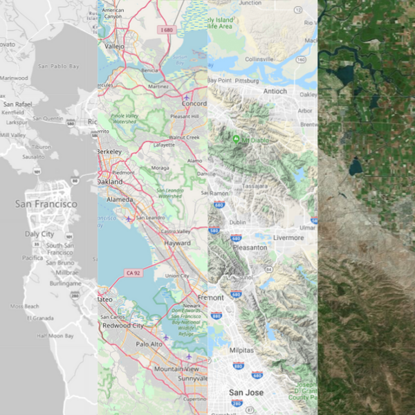
Population Explorer Basemap Types
- Open Street - Our go-to map type both for its accuracy and visual clarity
- Bing Roads - A helpful and clean map interface for mapping roadways
- Bing Grayscale - The dark background of this map is helpful for making Markers and Items stand out
- Bing Aerial - Our current recommendation for satellite base maps for its visual clarity. This is also our favorite choice to overlay with population density.
- Google Roadmap - An always reliable Google base map
- Google Satellite - Googles basic satellite basemap
- Google Terrain - A unique hybrid of Google Satellite and Roadmap, we love this option for it accuracy and visual appeal
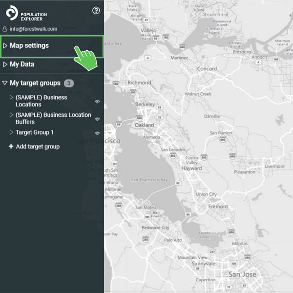
Open Map Settings
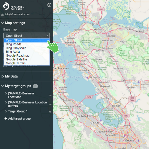
Select Your Desired Basemap
To change your basemap while in the PopEx App, simply open the Map Setting tab in the left menu and open the Base Map dropdown.
Population Explorer includes a variety of base maps to best accommodate the large number of use cases the app supports. The majority of our users will find the Open Street basemap to be most useful for placing markers to identify business locations, or determine unique boundaries by tracing roadways. For our users interested in more remote populations surrounded by geographic features, they find the Bing or Google Aerial maps to be most useful.
Population Density
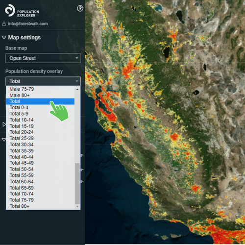
Adding a Density Overlay
Within the Map Setting tab, you can expand the density overlay options menu. The various overlays are distributed by gender and age group. We most commonly use the group Total, which represents the density of the entire population, regardless of age and gender.
You can overlay a population density heat map over the top of any base map. The current resolution of the density overlay is 1,000 meters.
Organizations commonly utilize population density to quickly determine the shape of their market area, and define territories for demographic assessment and business expansion. Our humanitarian clients use the overlay as an initial step in determining where to geographically focus aid and medical efforts after an earthquake, or viral outbreak.
To turn the density overlay off, expand the density options menu and select None.
Additional Settings
Marker Labels and Map Tracking
• Turn off Marker Labels - Unselecting this option prevents marker labels from appearing on the map, potentially obscuring the map view.
• Turn off Map Tracking - Unselecting this option prevents the map from centering on Target Groups or Items upon selection. We recommend unselecting this option if you are analyzing multiple boundaries over a large geographic area. as it minimizes map disorientation.